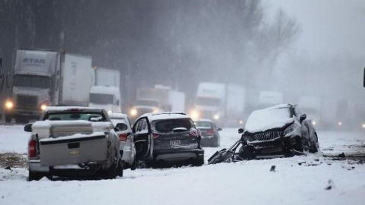
Ever since driving in a sudden snow squall in Columbus, OH while in college, I have contended that these sudden snow squalls, some of which produce only a quarter to half inch of accumulation but reduce visibility to zero and can glaze over roads in half the county in minutes, are the most dangerous winter weather hazard. I am thrilled to see the National Weather Service finally recognize this and take action on this. All I can add is this: if a snow squall warning is issued, take it seriously. It could be a matter of life or death if on the road.
WHAT
This is a new warning issued by the National Weather
Service. It is a polygon warning, generally
30-60 minutes in
duration, that is issued similar to severe thunderstorm and
tornado warnings.
WHEN
Begins November 1st.
WHY
A snow squall is an intense
short-lived burst of heavy snowfall
that leads to a quick reduction in visibilities and is often
accompanied by gusty winds. Sudden whiteout conditions and
slick roadways can lead to high speed accidents with large
pileups that result in injuries and fatalities. This new warning
aims to bring better situational awareness to drivers and
mitigate impacts related to these squalls.
–