Rare Peek at Patagonia in Winter

Rare Peek at Patagonia in Winter

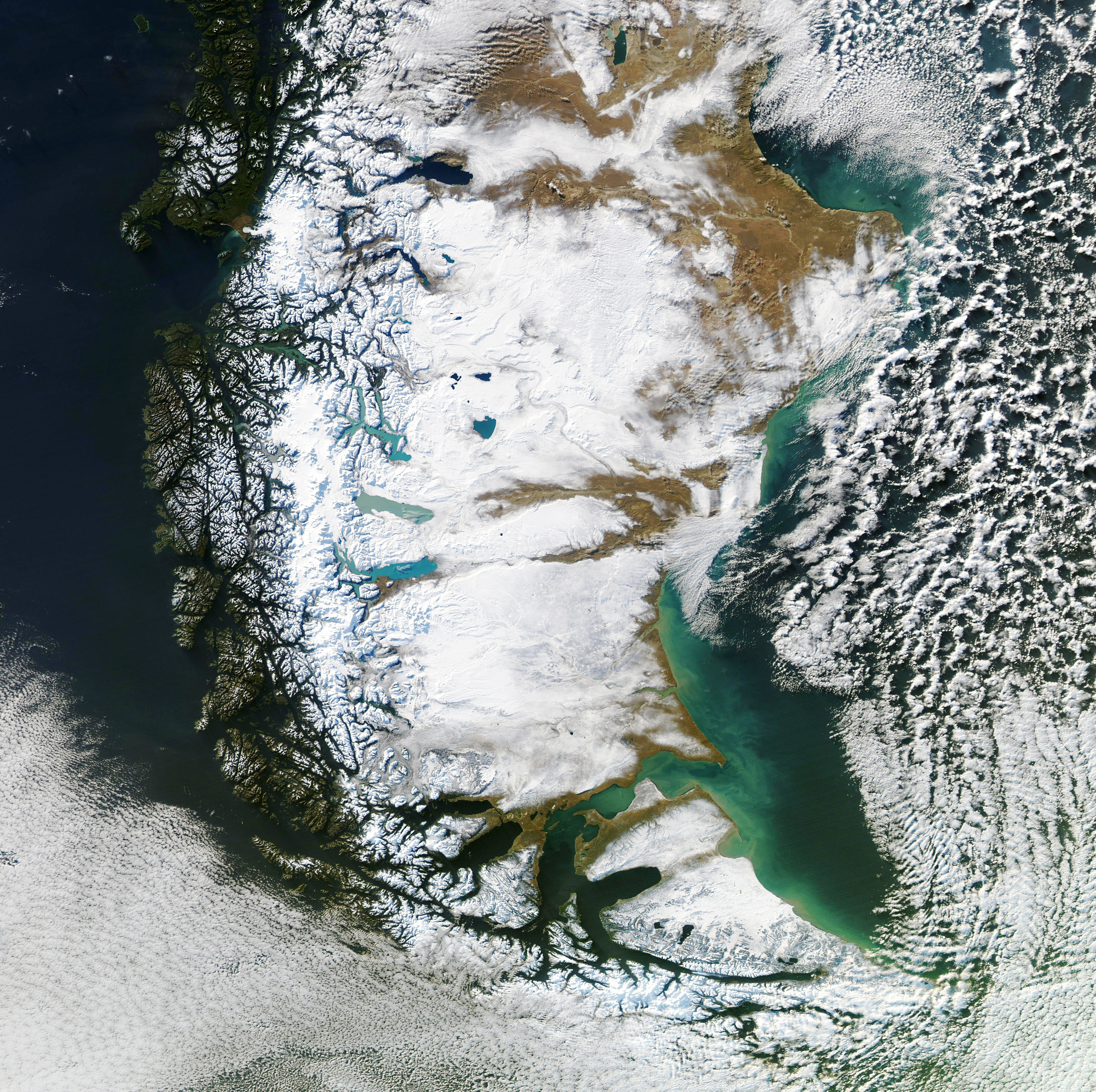
In southern South America, clouds often rule the skies. But in June 2020, just the right weather patterns were in place to provide a rare, clear view of Patagonia in winter. On June 26, when the Moderate Resolution Imaging Spectroradiometer (MODIS) on NASA’s Aqua satellite acquired these images, skies were clear over nearly all of Patagonia, which spans more than 1 million square kilometers of the continent’s southern end.

Read more here>>>

Keeping a steady eye on sea level change from space

Coastal areas around the world – such as the Zambezi River Delta shown in a Landsat 8 satellite image – are contending with the consequences of a warming planet including droughts and floods, in addition to changing sea levels. Credit: : NASA

Over the course of nearly three decades, an uninterrupted series of satellites has circled our planet, diligently measuring sea levels. The continuous record of ocean height that they’ve built has helped researchers reveal the inner workings of weather phenomena like El Niño and to forecast how much the ocean could encroach on coastlines around the world. Now, engineers and scientists are preparing two identical satellites to add to this legacy, extending the dataset another decade.

Read more here>>>