
 That term went viral four years ago, but it has been around since 1853 (!) and in peer-reviewed papers since at least 1939. Read more here.
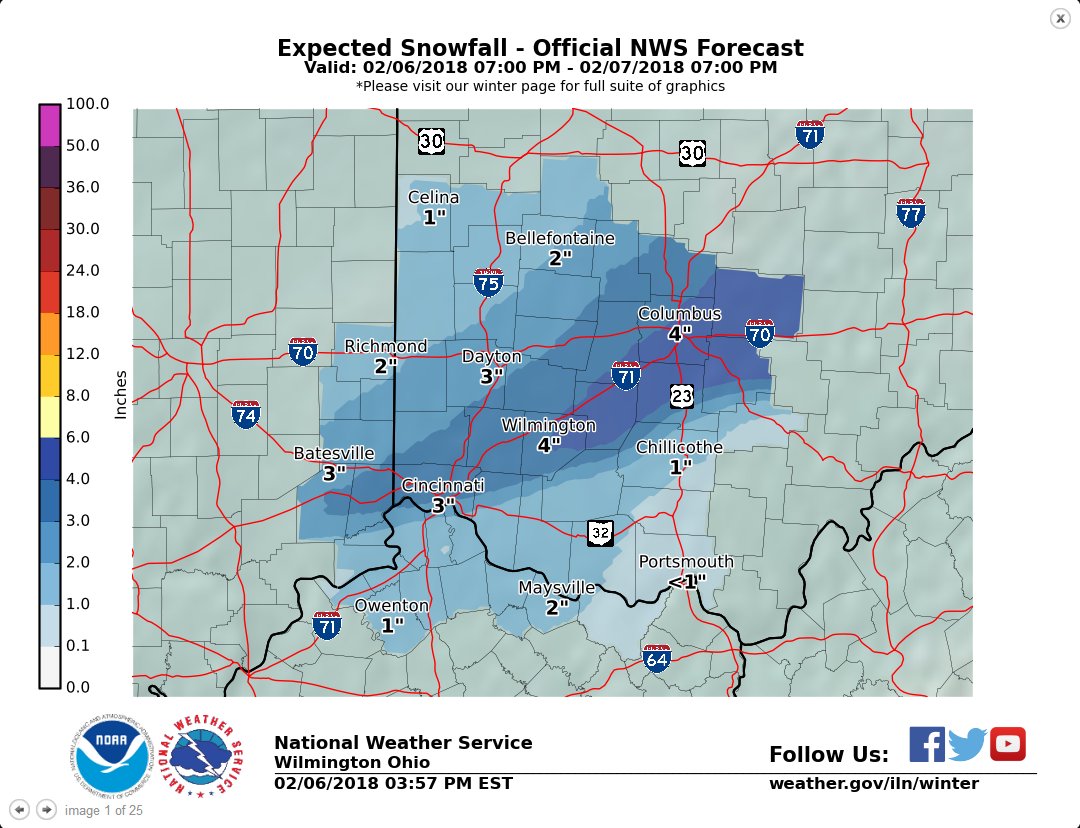
Winter Storm Warning For Cincinnati and Ohio Valley
Updated snow and ice maps for tonight’s system. The crossover where snow/ice overlap has a high uncertainty of forecast accumulations, as more snow would lessen ice accumulation, and more freezing rain would significantly cut snow totals. Begins after midnight most areas.
Winter Storm Warning
URGENT - WINTER WEATHER MESSAGE
National Weather Service Wilmington OH
407 PM EST Tue Feb 6 2018

...WINTER STORM WARNING REMAINS IN EFFECT FROM 10 PM THIS EVENING
TO 1 PM EST WEDNESDAY...

* WHAT...Mixed precipitation expected. Total snow accumulations
  of 2 to 4 inches, with localized amounts up to 5 inches, and
  ice accumulations of up to two tenths of an inch are expected.

* WHERE...Portions of Southeast Indiana, Northern Kentucky and
  Central, South Central and Southwest Ohio. The higher ice
  totals will be mainly south of Interstate 71 with the highest
  snowfall totals along Interstate 71.

* WHEN...From 10 PM this evening to 1 PM EST Wednesday.

* ADDITIONAL DETAILS...Plan on difficult travel conditions,
  including during the morning commute on Wednesday. Be prepared
  for significant reductions in visibility at times.

PRECAUTIONARY/PREPAREDNESS ACTIONS...

A Winter Storm Warning means significant amounts of snow, sleet
and ice will make travel very hazardous or impossible. Additional
information can be found at www.weather.gov/iln as well as on our
Facebook and Twitter pages.