
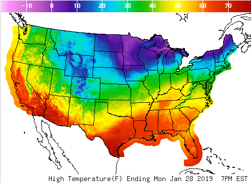
 A temperature roller coaster is predicted over the next couple weeks . Warm temperatures Monday in Cincinnati with evening rain changing to snow. A light accumulation and slick roads are possible overnight before the Tuesday morning commute although any snow will have ended before dawn. More snow showers are possible Tuesday evening through Wednesday morning. Any accumulation would be light and scattered, but any snow shower could be briefly heavy with reduced visibilities.
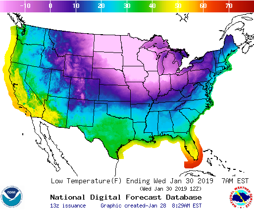
Some of the coldest temperatures in years are moving into the midwest, Great Lakes, Ohio valley and northeast with lows colder that -40 in some northern areas, and likely near -20 as far south as northern Indiana. Despite a lack of snow cover which would chill the air even more, Cincinnati could bottom out as low as -5 Thursday morning with a daytime temperature in the single digits Wednesday, accompanied by wind gusts as high as 30 mph.
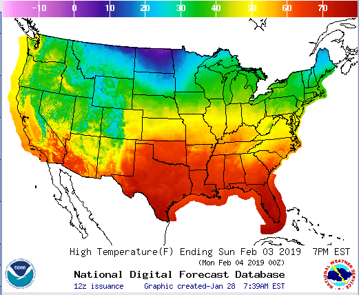
Temperatures wil rebound rather quickly by the weekend with Sunday’s high in Cincinnati near 50!
After that, cold air will work its way in from the north with an active storm track and by the second week of February. Winter isn’t done with us yet!

