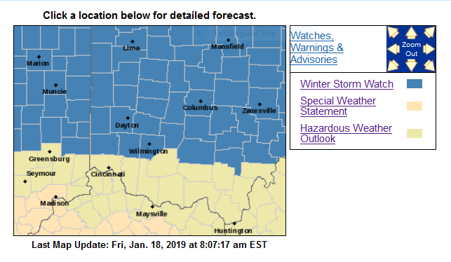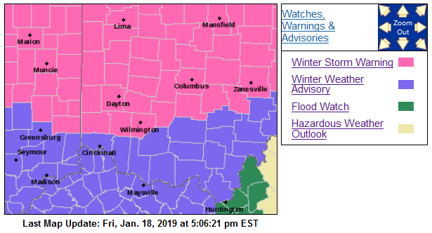
Winter Weather Advisory
URGENT – WINTER WEATHER MESSAGE
National Weather Service Wilmington OH
328 PM EST Fri Jan 18 2019
INZ073>075-080-KYZ091>093-OHZ077>080-190430-
/O.NEW.KILN.WW.Y.0003.190119T1900Z-190120T1300Z/
Ripley-Dearborn-Ohio-Switzerland-Boone-Kenton-Campbell-Hamilton-
Clermont-Brown-Highland-
Including the cities of Batesville, Milan, Versailles,
Lawrenceburg, Aurora, Rising Sun, Vevay, Florence, Burlington,
Oakbrook, Covington, Erlanger, Independence, Newport, Alexandria,
Cincinnati, Milford, Georgetown, Mount Orab, Hillsboro,
and Greenfield
328 PM EST Fri Jan 18 2019
…WINTER WEATHER ADVISORY IN EFFECT FROM 2 PM SATURDAY TO 8 AM
EST SUNDAY…
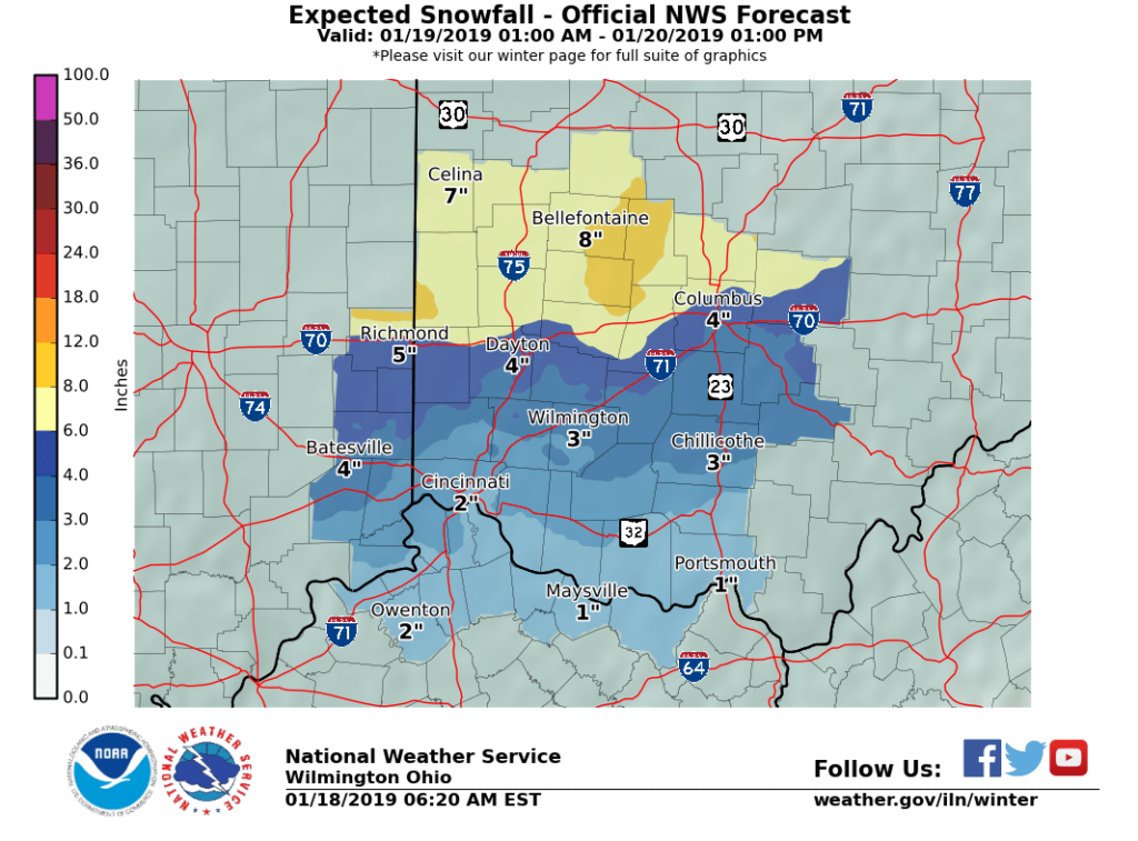
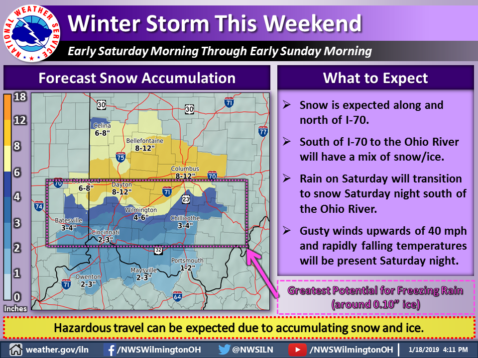
* WHAT…Snow expected. Total snow accumulations of 2 to 4 inches
expected. Winds gusting as high as 35 mph. Cold air rushing in
on Sunday will cause any lingering water to freeze overnight,
creating additional roadway hazards.
* WHERE…Portions of Southeast Indiana, Northern Kentucky and
South Central and Southwest Ohio.
* WHEN…From 2 PM Saturday to 8 AM EST Sunday.
* ADDITIONAL DETAILS…Plan on slippery road conditions.
PRECAUTIONARY/PREPAREDNESS ACTIONS…
A Winter Weather Advisory for snow means periods of snow will
cause primarily travel difficulties. Expect snow covered roads
and limited visibilities, and use caution while driving.
Winter Storm Warning
URGENT – WINTER WEATHER MESSAGE
National Weather Service Wilmington OH
328 PM EST Fri Jan 18 2019
INZ058-059-066-OHZ060>063-070>072-190430-
/O.UPG.KILN.WS.A.0002.190119T0900Z-190120T0900Z/
/O.EXA.KILN.WS.W.0002.190119T0900Z-190120T0900Z/
Fayette IN-Union IN-Franklin IN-Preble-Montgomery-Greene-
Fayette OH-Butler-Warren-Clinton-
Including the cities of Connersville, Liberty,
West College Corner, Brookville, Eaton, Camden, Dayton,
Kettering, Beavercreek, Fairborn, Xenia, Washington Court House,
Hamilton, Middletown, Fairfield, Oxford, Mason, Lebanon,
Springboro, Wilmington, and Blanchester
328 PM EST Fri Jan 18 2019
…WINTER STORM WARNING IN EFFECT FROM 4 AM SATURDAY TO 4 AM EST
SUNDAY…
* WHAT…Heavy mixed precipitation expected. Total snow
accumulations of 3 to 9 inches and ice accumulations of around
one tenth of an inch expected. Winds gusting as high as 35 mph.
* WHERE…Portions of East Central and Southeast Indiana and
Central, Southwest and West Central Ohio.
* WHEN…From 4 AM Saturday to 4 AM EST Sunday.
* ADDITIONAL DETAILS…Travel could be very difficult.
PRECAUTIONARY/PREPAREDNESS ACTIONS…
A Winter Storm Warning means significant amounts of snow, sleet
and ice will make travel very hazardous or impossible.